
Research
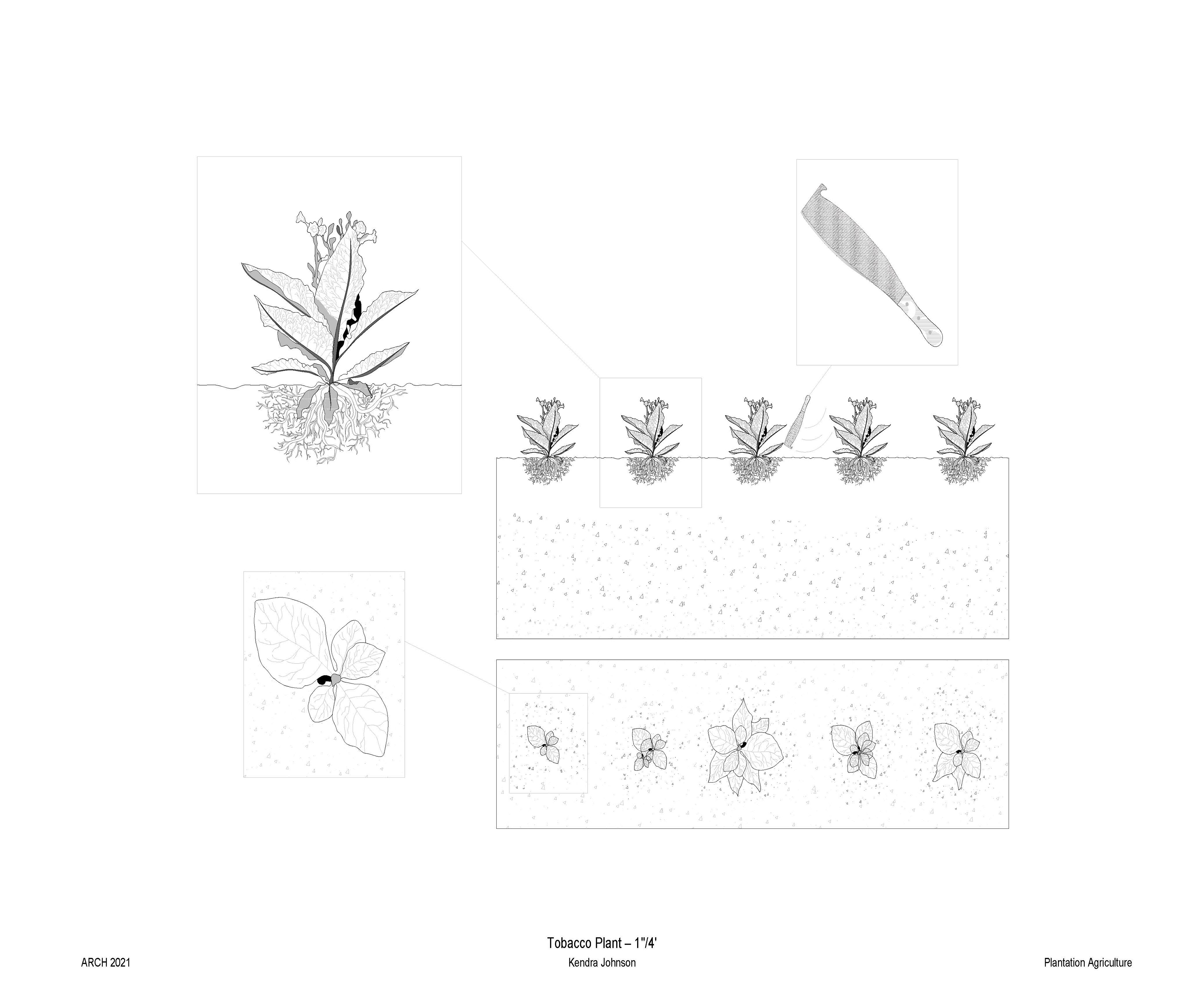
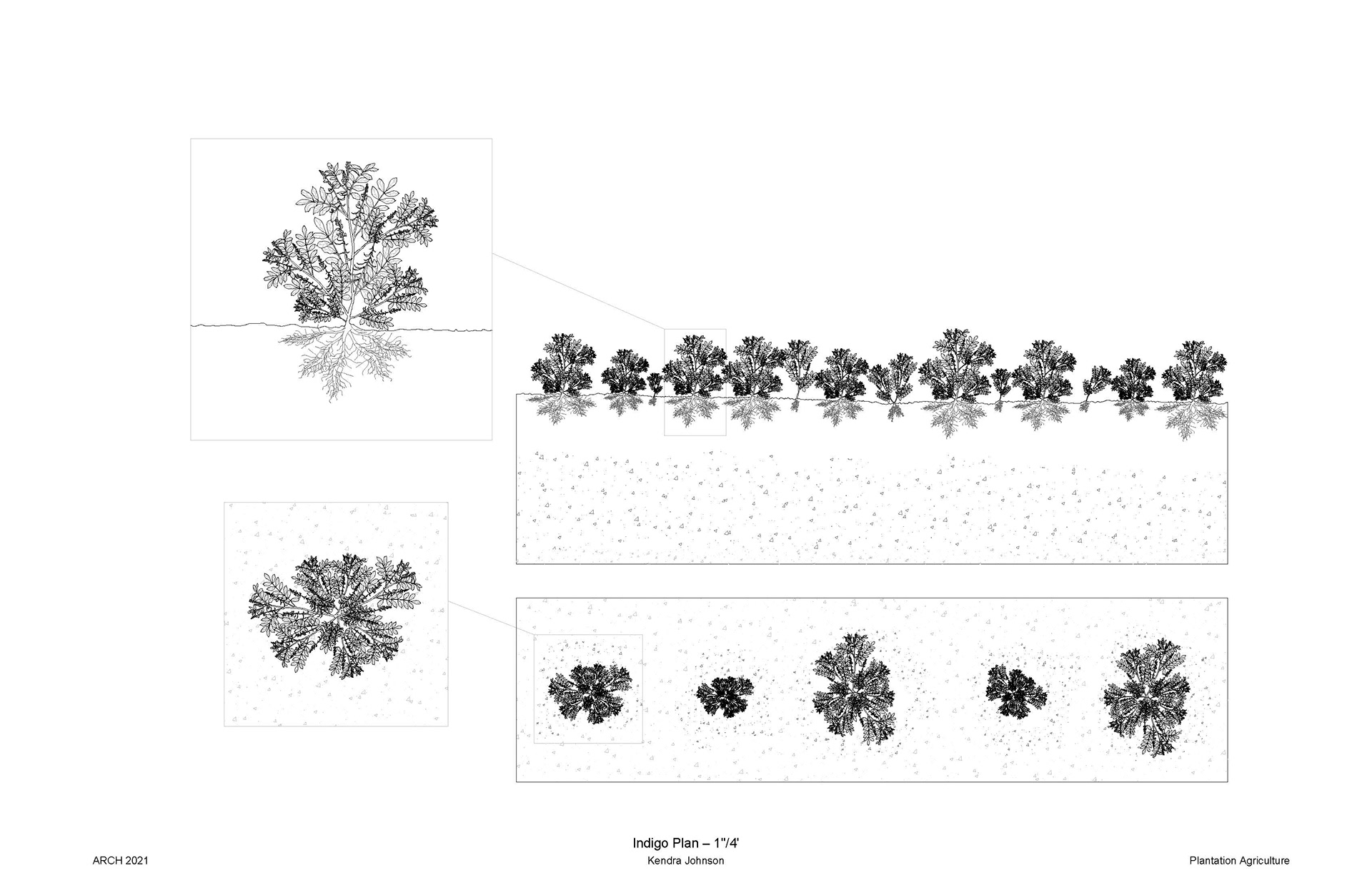
I researched plantation vegetation in the Norco, LA area. This data is going to be used to help inform our site context. I focused on Tobacco and Indigo agriculture in Louisiana plantations. Then I digitally rendered plans and sections using correct measurements. I included tools and planting spacing information. Now the drawings can be used in my future project for the Norco spillway this coming semester.
Research
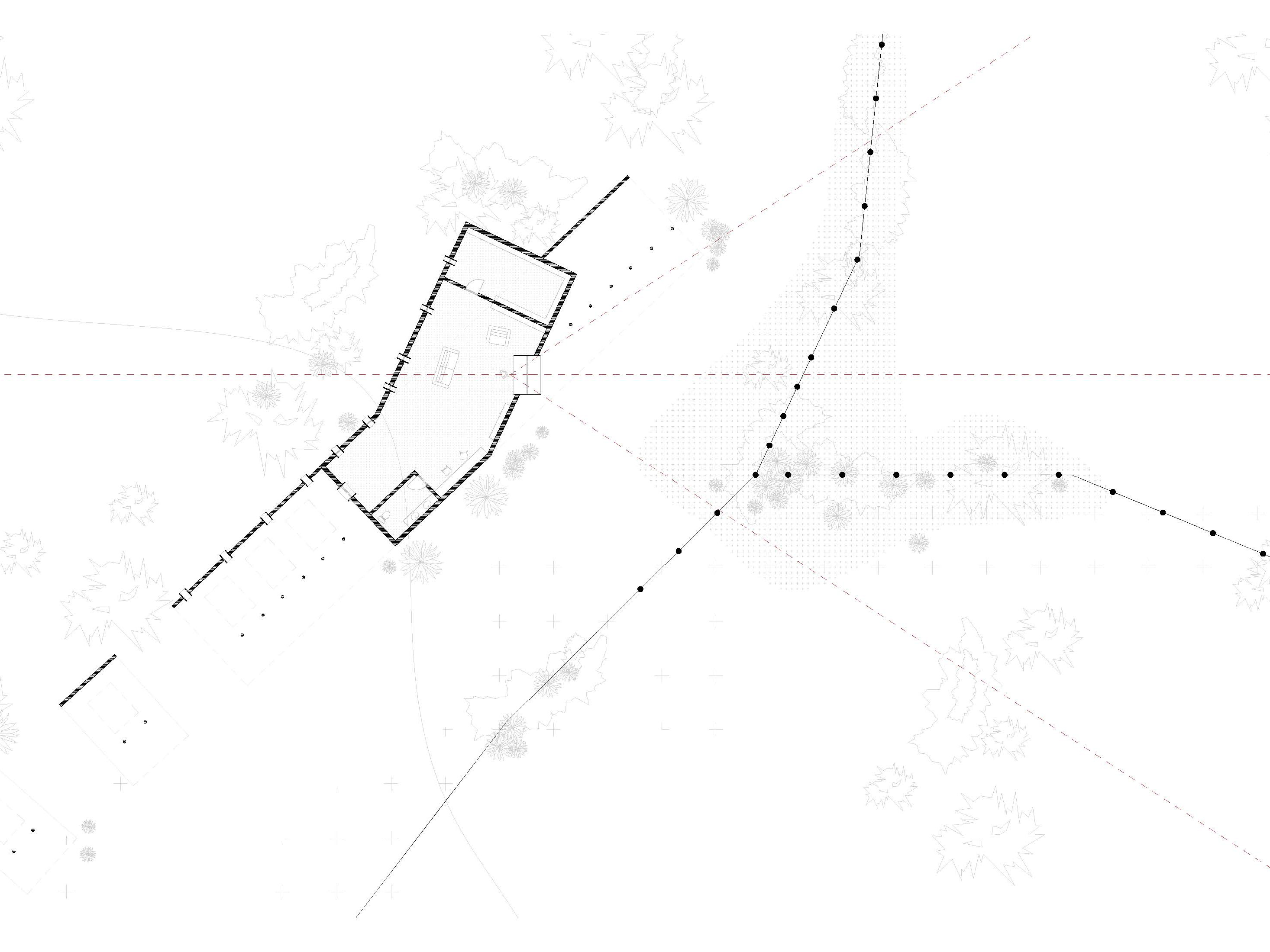
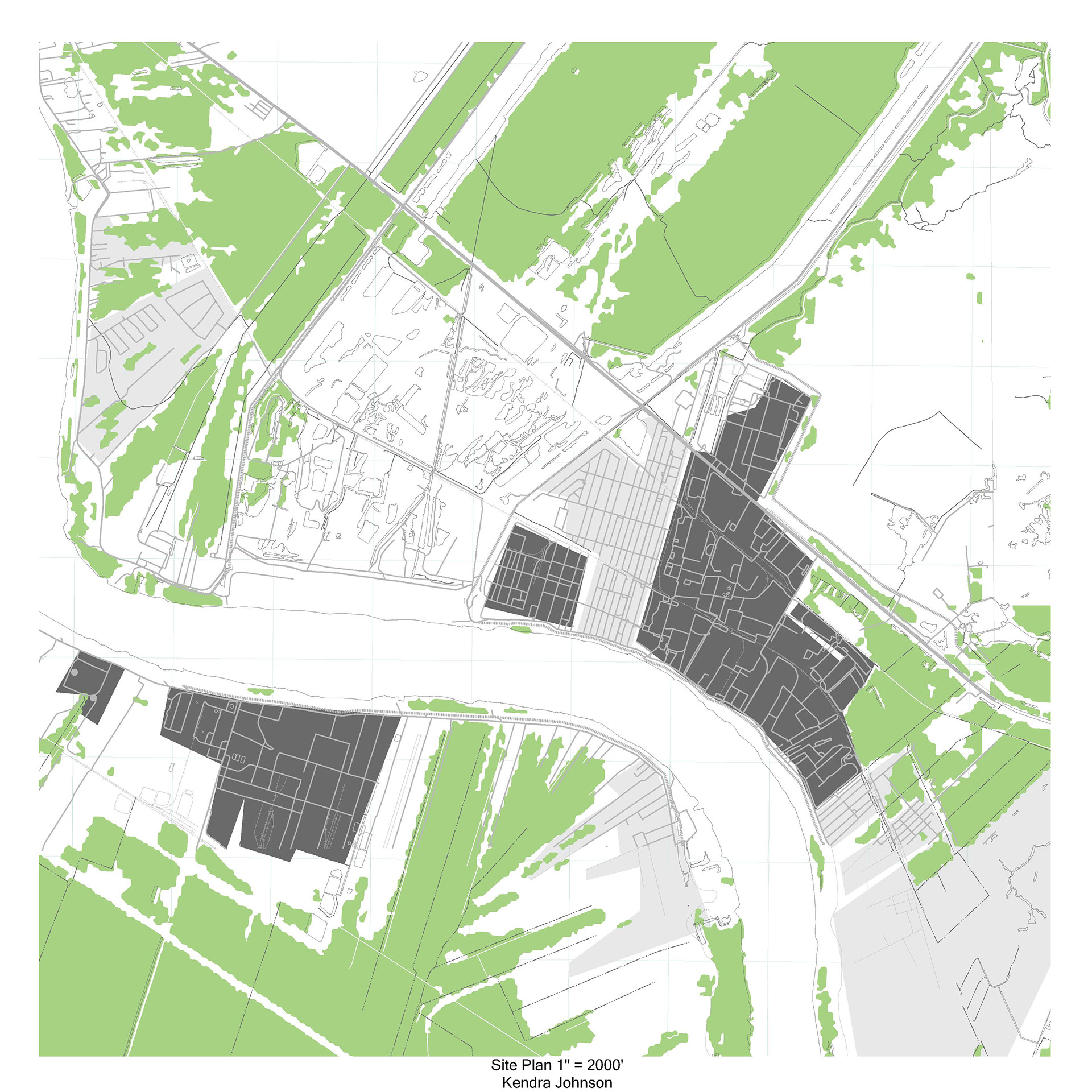
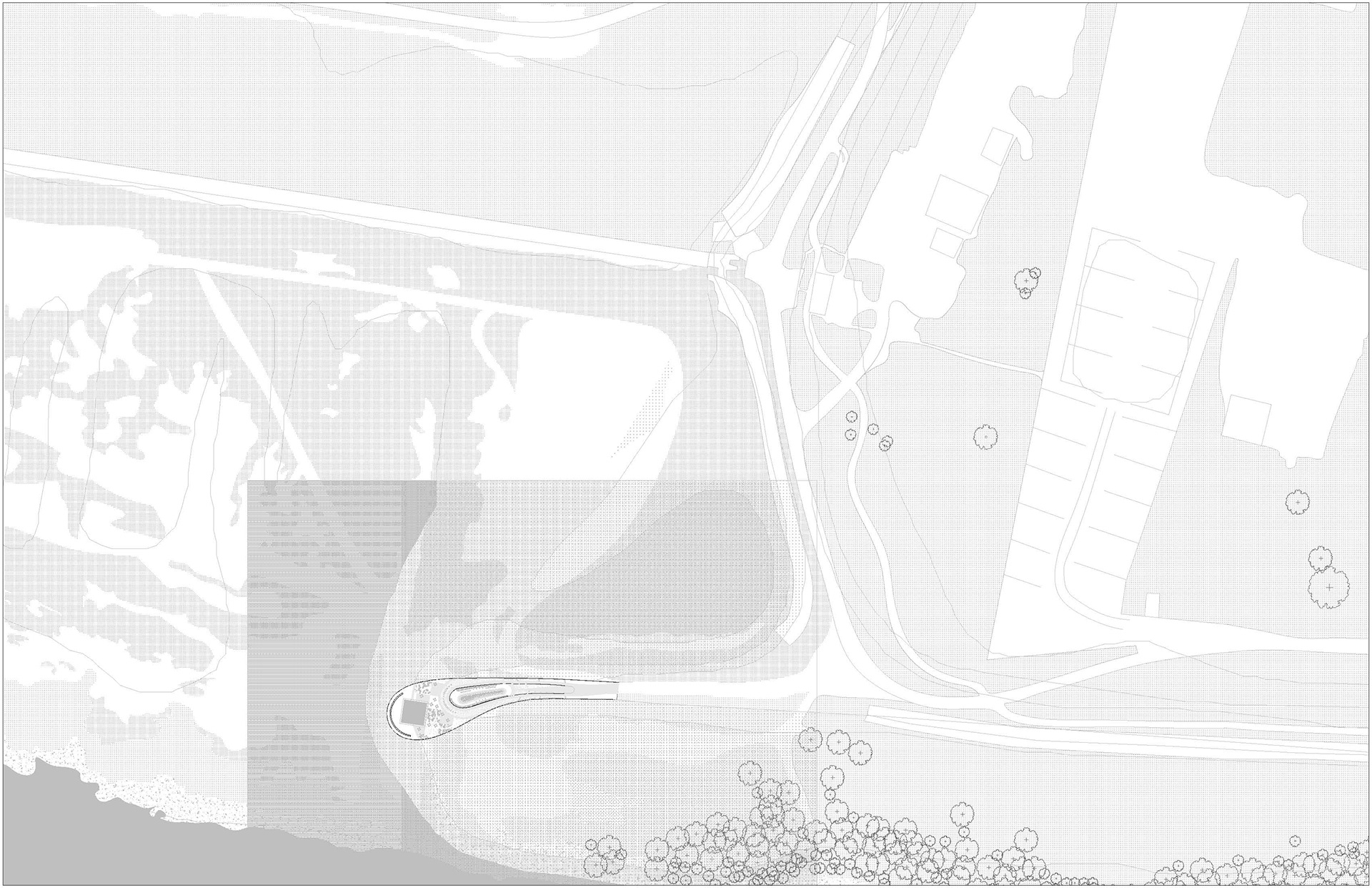
The first map of the Norco spillway investigates water and human pathways, and their relationship to the Louisiana sinking rates. The map includes waterways in a blue hatch and roads in a light gray. Layered on top, in a transparent blue, is the Mississippi River from 1858. The fastest sinking rate areas are dark hatch, the medium sinking rate areas are medium hatch, and the slowest sinking rate areas are light hatch. This map shows how the river's changing path correlates with the area's sinking rate.
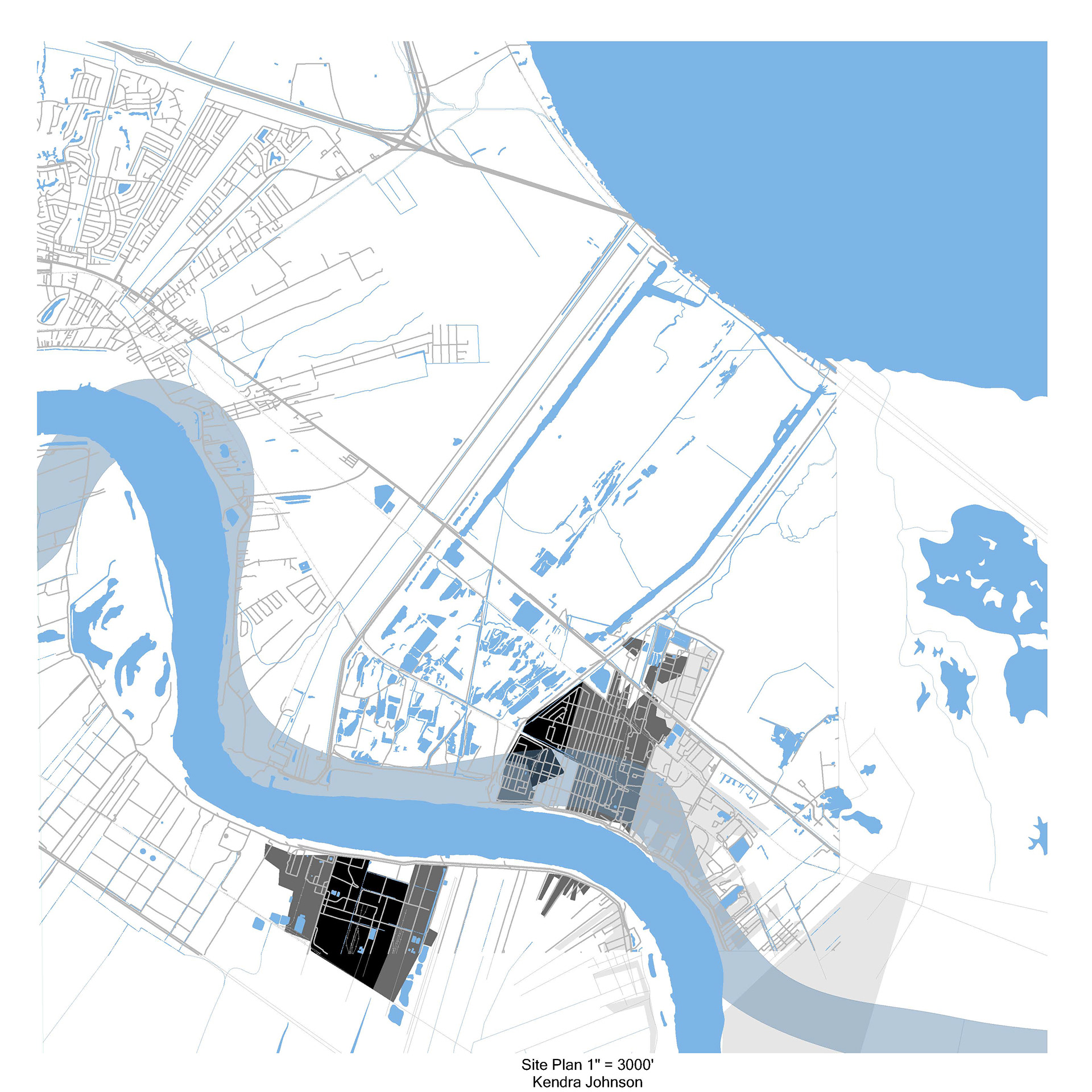
The second map of the Norco spillway investigates the relationship between nature and humans. The remaining vegetation is given a green hatch. Then I showed what areas of human impact are residential or factory. The residential area is a light gray hatch and the factory area is a darker gray hatch.
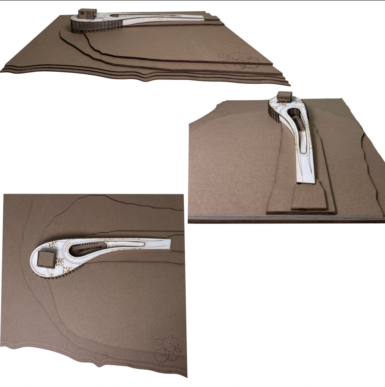
Proposal
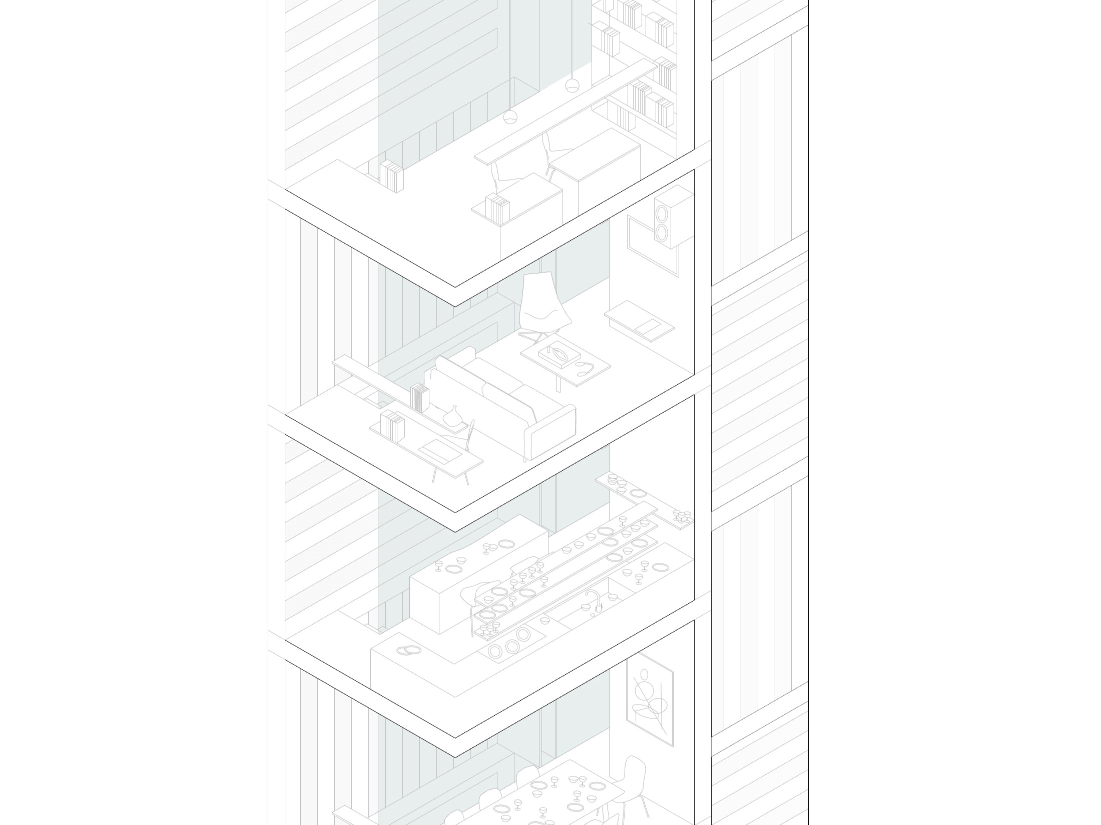
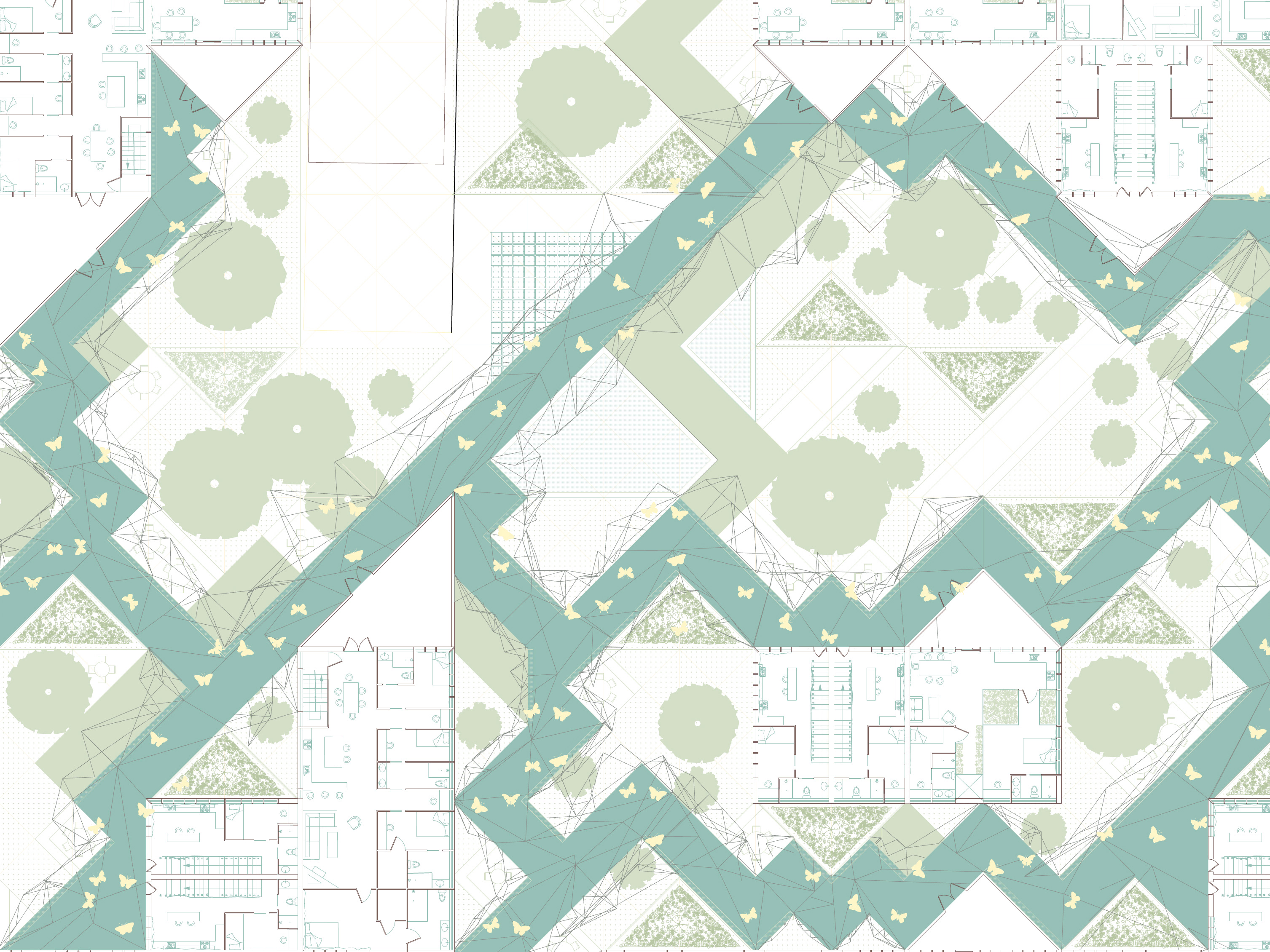
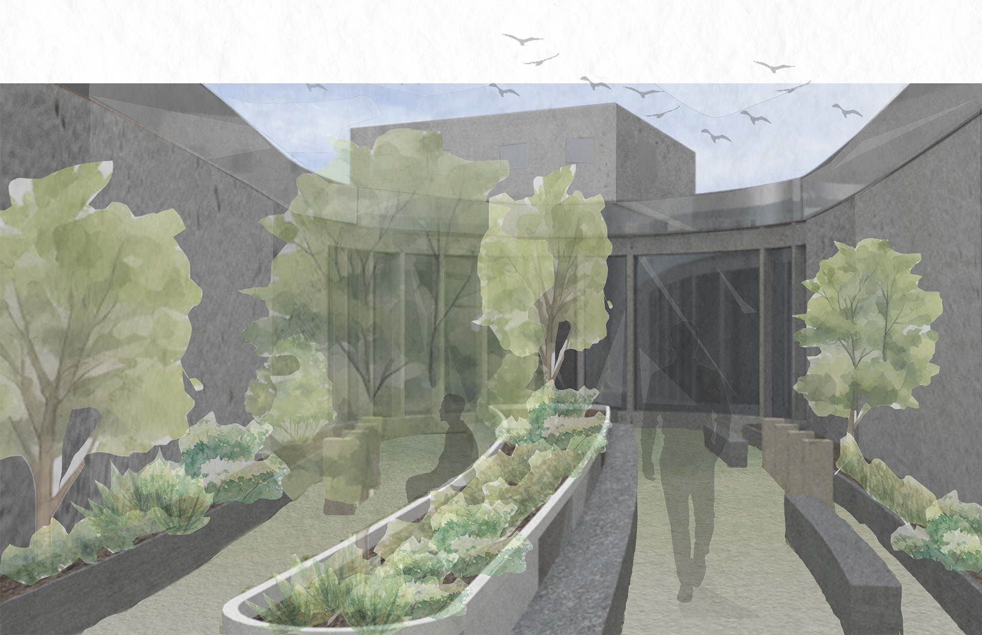
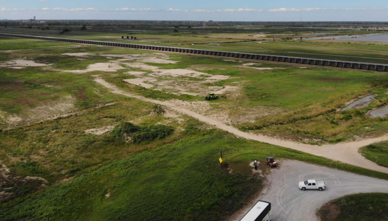
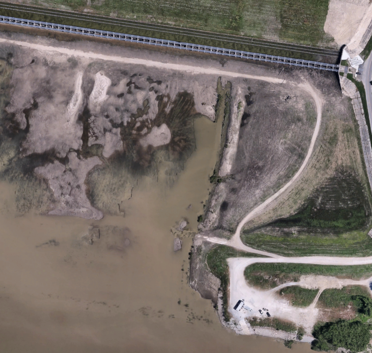
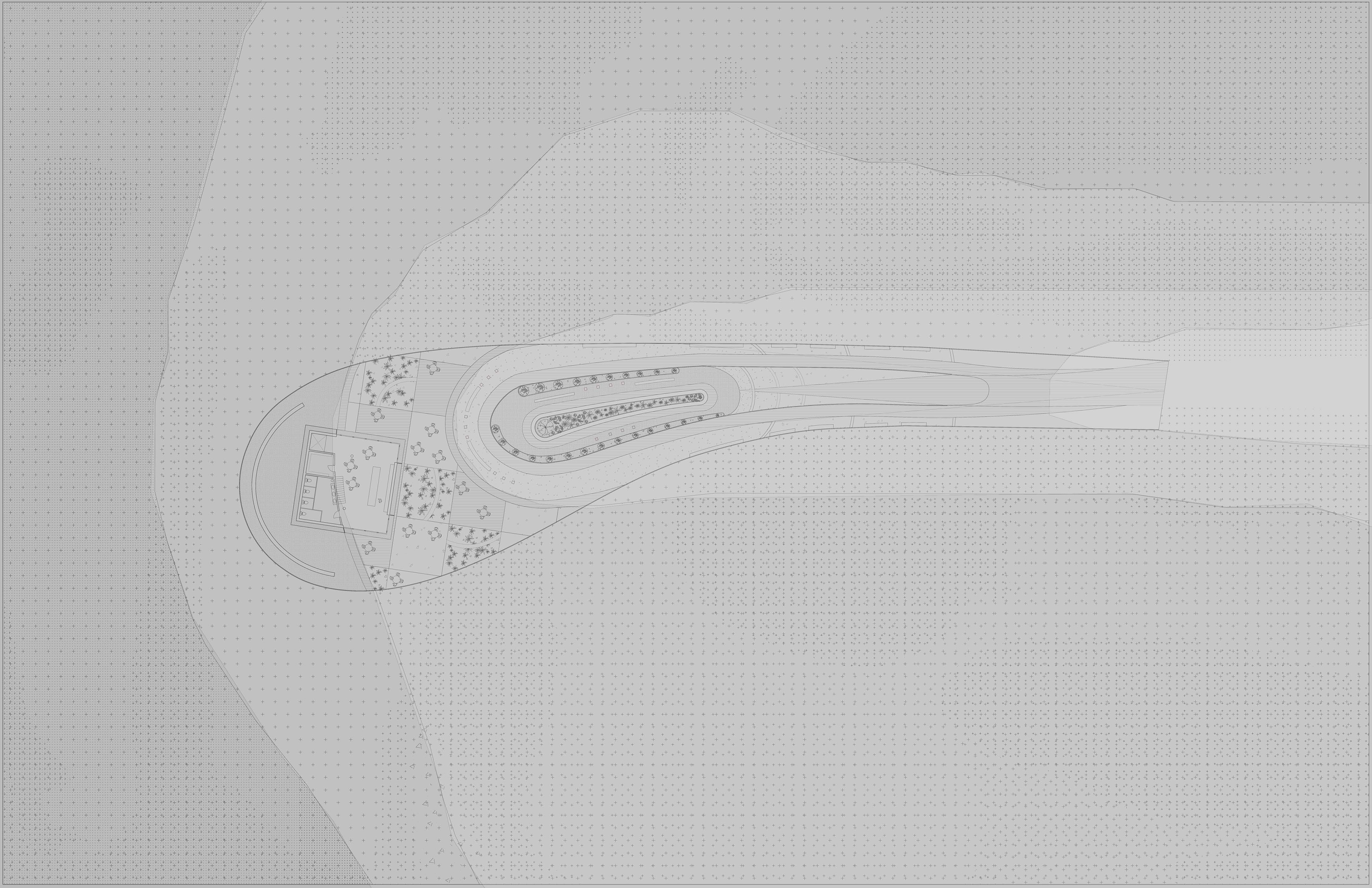
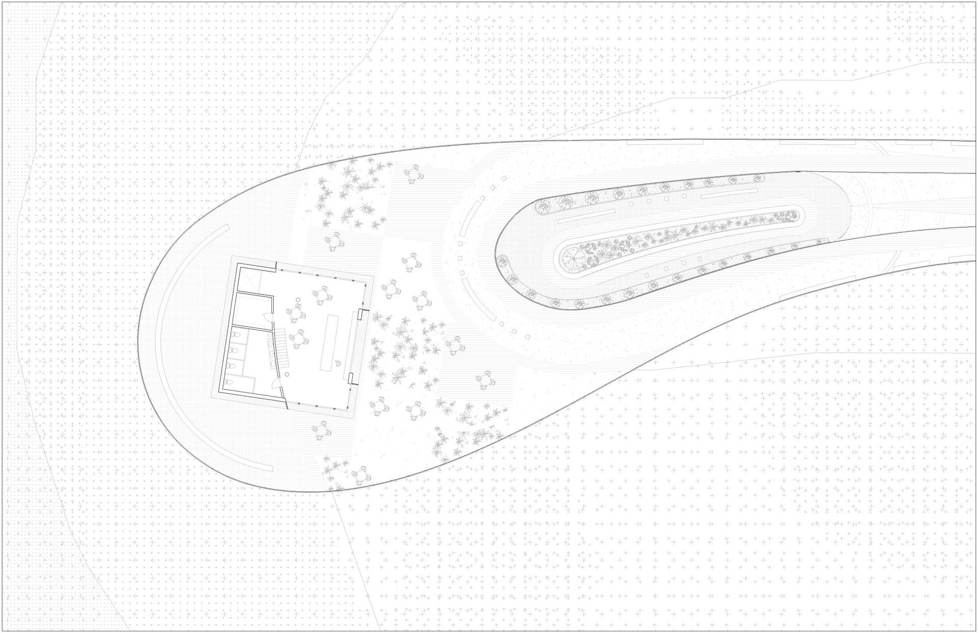
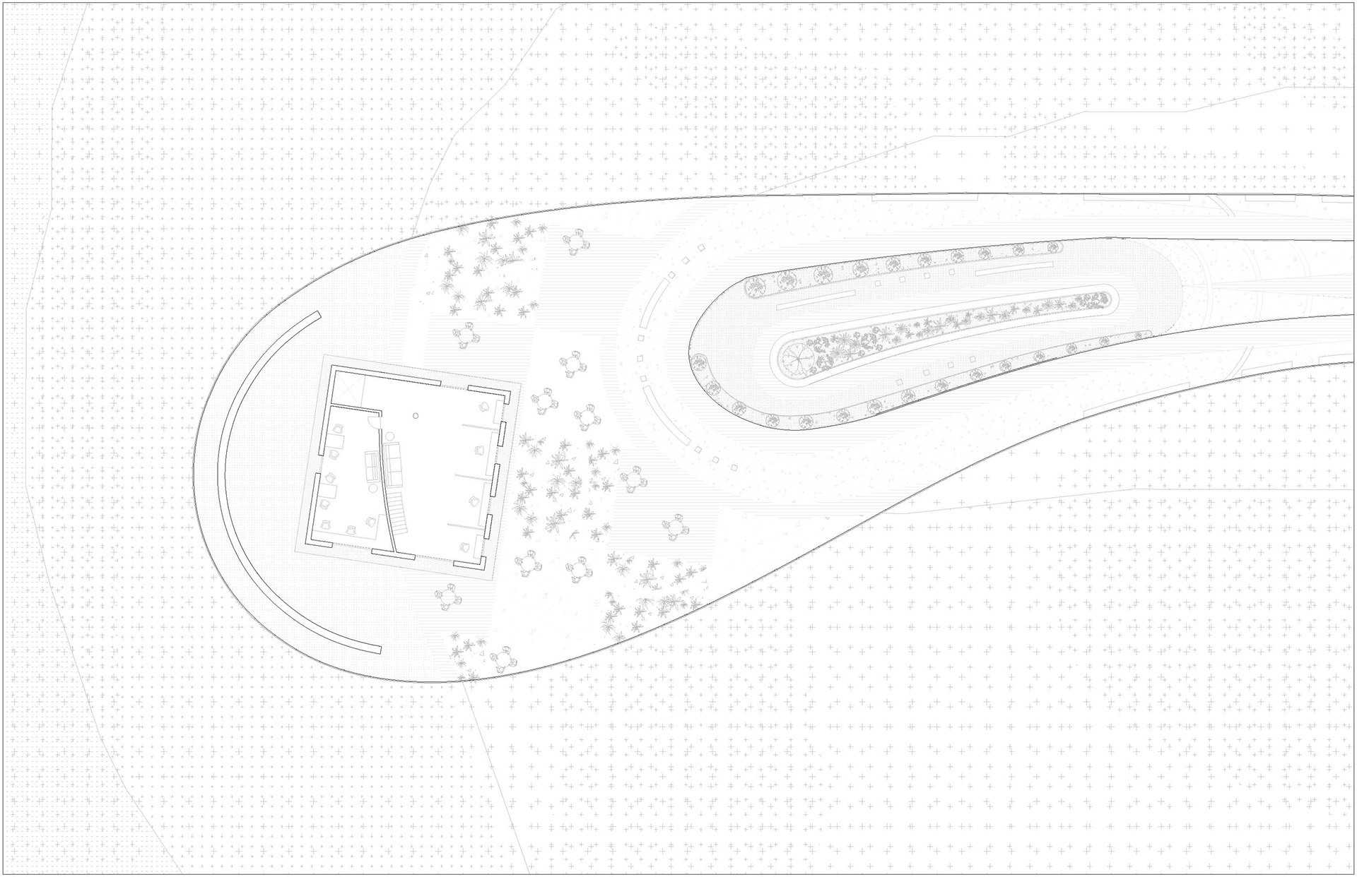
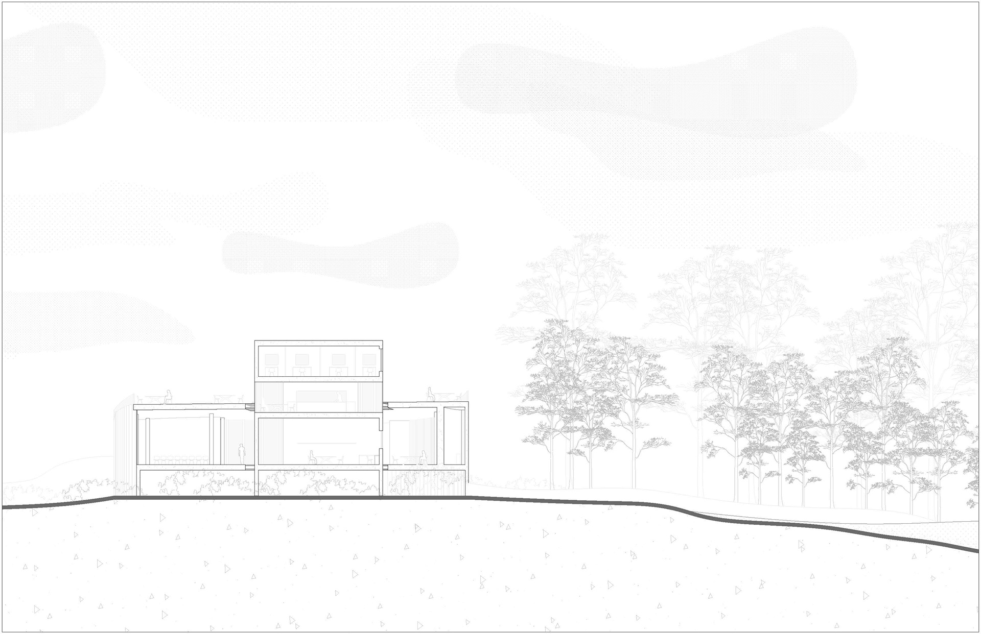
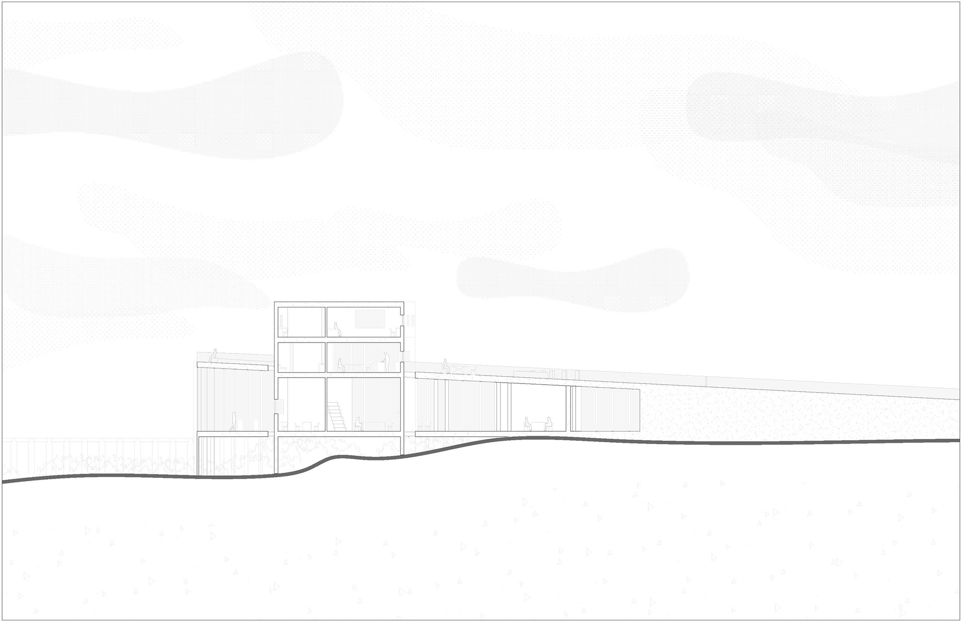
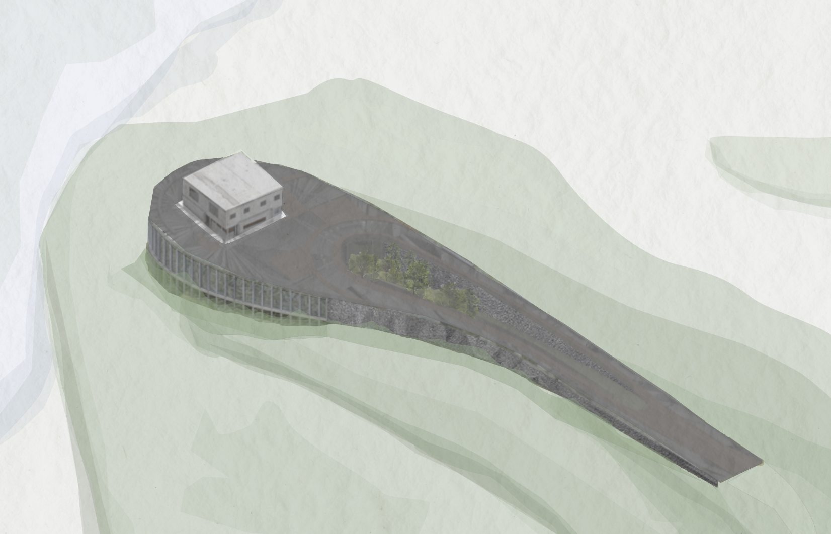
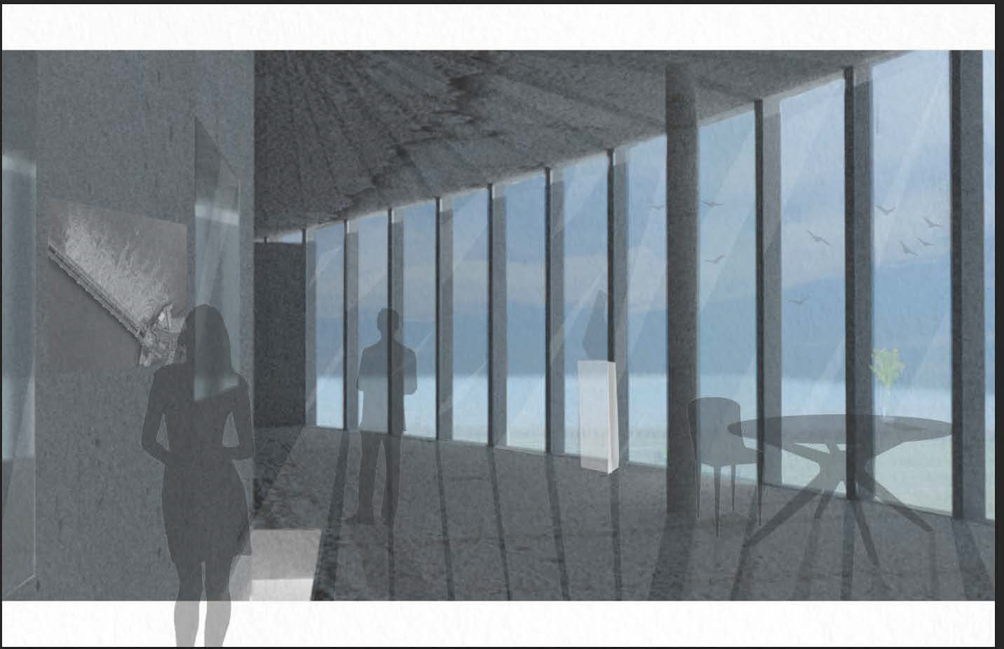
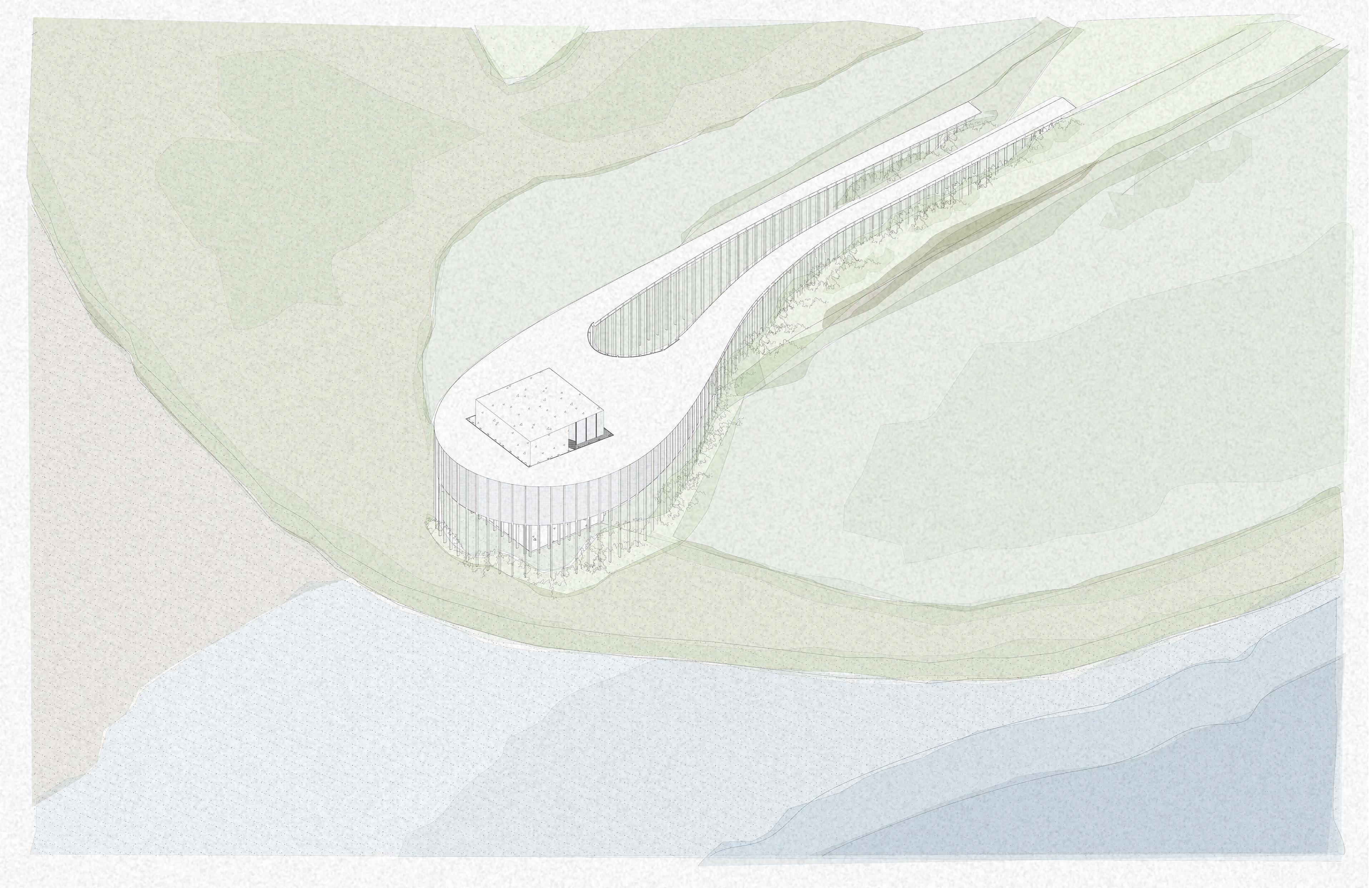
This proposal is a visitor center for the Spillway in Louisiana that includes a research center and park rangers' office. The proposal focuses on water erosion and the changing of the Mississippi River. The organic tear drop shape is derived from a mapping of the topography on the site. The entrance is located at the highest point in the topography connected to an existing path. The first entrance is down a ramp into the main lobby. The second entrance is through the "board walk" pathway on the roof of the building. This gives the visitors access to views of the spillway and can stay dry when the spill way floods. The ramped roof has lots of sitting by the cafe and as you walk along the building. The landscape on the roof follows the topography lines. Then the visitor can enter from the roof into the second-floor cafe. The organic shape holds all the main public spaces on the first floor. This includes the gallery, video center, community center, and lobby. Then the organic shape is pierced with this orthogonal slanted square. The square reflects the spillway that is linear and cuts through the organic landscape. Between the square and organic shape with a glass floor for visitors to see down to the floor of the spillway. This square is angled parallel to the spillway. In the square holds the more private spaces. The first floor is the least private and the third floor is the most private. The first floor contains the research center and main meeting room. The second floor contains the cafe that opens to the slanted roof, the restrooms and storage space. The third and top floor contains the ranger center and operation rooms. The exterior vertical windows are spaced to mimic the bays of the spillway. In the interior square, windows are placed with relation to the interior program with glass sliding doors opening from the organic space. The stairs and interior walls in the square follow the topography of the erosion. The columns throughout the building, interior square size, and landscape of the roof follow a grid that is the widths of spillway bays. The interior organic walls follow the topography lines. As you approach the building, there are two ramps. One down into the main entrance and one up to the roof. This allows for great views and to feel like the building swells up around you. Final when the spillway is flooded, the building will appear to be an island. When you stand inside the building or on the roof you will be surrounded by water. This gives you an experience of the spillway no matter the time of year. This project focuses on the erosion of the Mississippi River and how manmade structures juxtapose nature.


Thank You!
Completed: (Architecture Studio) (Professor: Megan Slattery) (Tulane University)